Answering the Call
A legacy of Service
A profession is a calling or vocation requiring specialized knowledge and often long and intensive academic preparation for the purpose of providing objective counsel or service to others. Land surveying is one of the oldest learned professions, and one of the first practiced in the United States. Washington, Jefferson, and Lincoln all practiced land surveying prior to becoming President. We’re proud to carry on the tradition of service to others those giants left us. Whether you need to document storm damage, mediate a property dispute, inspect a roof, solve a drainage issue, map your field tile, split the family farm for your children, gather stunning imagery to help you sell or buy real estate, or just want a new aerial perspective of the land you hold dear, we’re here to help.

Professional Services
Aerial Photography & Video
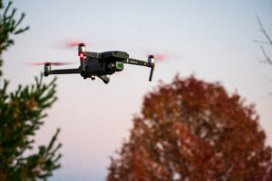
sUAS (Drone) technology is a game changer. Safe, rapid acquisition of topographic data and imagery from the air is more efficient in many respects than terrestrial based methods. Drones allow a remote pilot to collect stunning high definition imagery and video simultaneously, limiting time spent on site or subject to weather delays. The volume of data collected in just a few minutes in the air far exceeds what can be obtained with conventional instruments. This results in fewer return trips to the site and allows data reduction and analysis from the comfort and safety of the office.
GIS Mapping, ORthophotography and 3d/4D Modeling
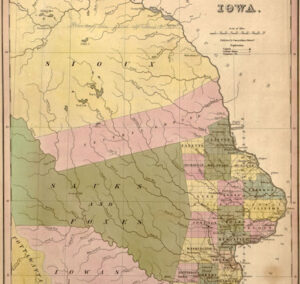
How we interact with spatial data has evolved rapidly in the last decade. Growing up in the Midwest, we carried a set of maps for each state we visited in the car so we could get where we wanted to go. Today we can travel anywhere in the world and our car can tell us where we are and how to get back. Rapidly acquired data over large areas modeled and stored in digital format makes all of that possible. Google has literally mapped the earth using photographs. We can help you map your little corner of it through time (4D). And if you’re old school and like to carry paper maps in your car along with a compass (like we do) in case the battery dies, we provide maps in legacy paper format as well.

Professional Engineering & Land Surveying
We bring years of skill, project experience all over the Midwest, and Iowa values to the table. We specialize in bringing neighbors together. We enjoy working on projects that benefit our community. We’re proud to call Lisbon home, so when you need an experienced, licensed, local professional, please give us a call.
- Real estate photography
- Real estate video
- Historical site preservation and modeling
- Orthophotos and mosaics
- Storm damage estimates and documentation
- Construction progress documentation
- Inundation studies
- Roof inspection
- Agricultural photography
- Infrastructure mapping and inventory with GIS:
- Basemaps
- Utilities
- Streets
- Structures
- Villages/Towns
- Digital Terrain Models (DTM’s) and surfaces
- Agricultural mapping
- 3D Modeling and virtual walkthroughs
- Stockpile estimation and volumes
- Boundary and topographic surveys
- Boundary line adjustments
- Farm splits
- Monument preservation
- Construction project management
- Construction staking
- Site plans
- Drainage design